


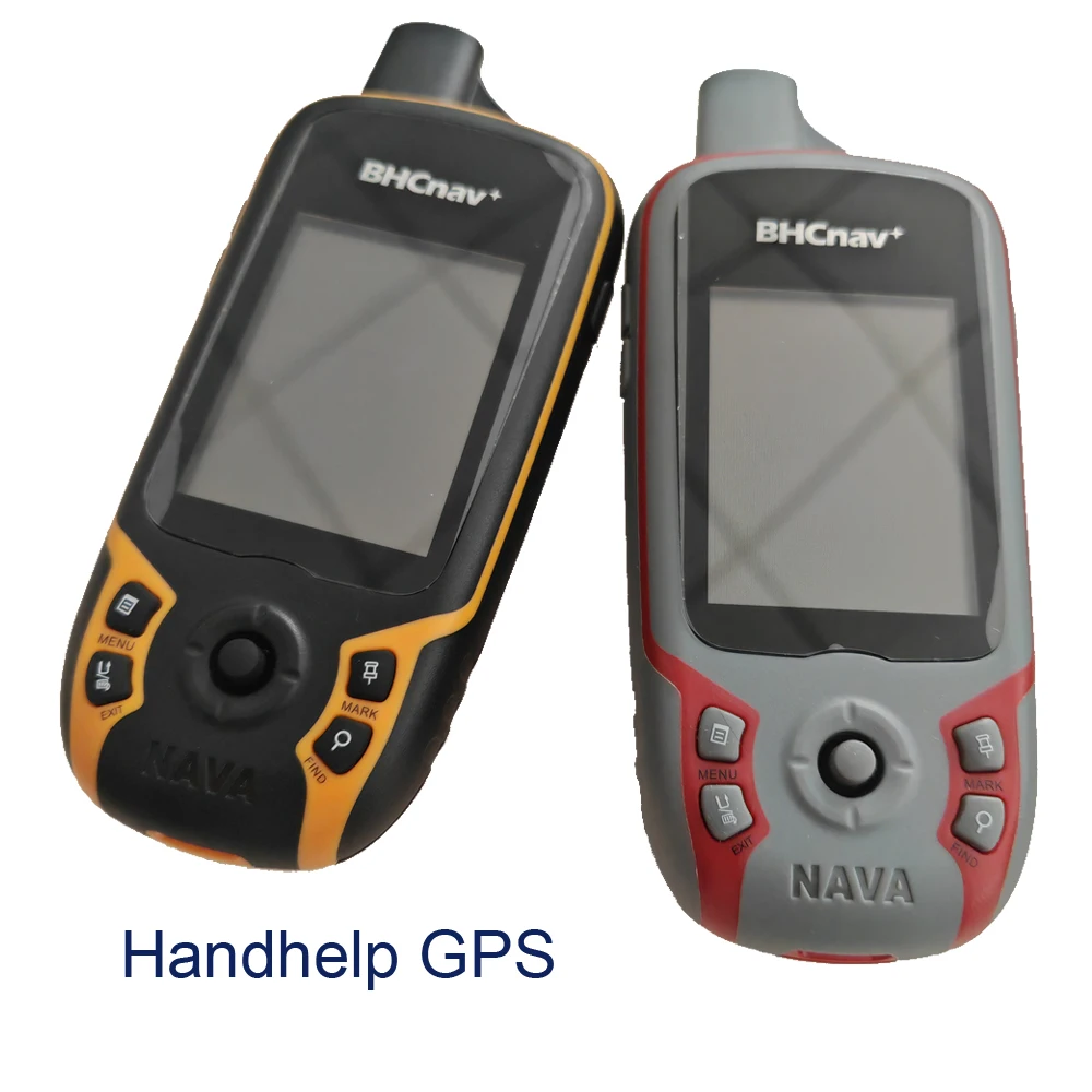
MIni Handheld GPS GLONASS with Waypoint Route Track Trip Map for Sailing track position marker Hand Help Satellite Navigation
SPECIFICATIONS
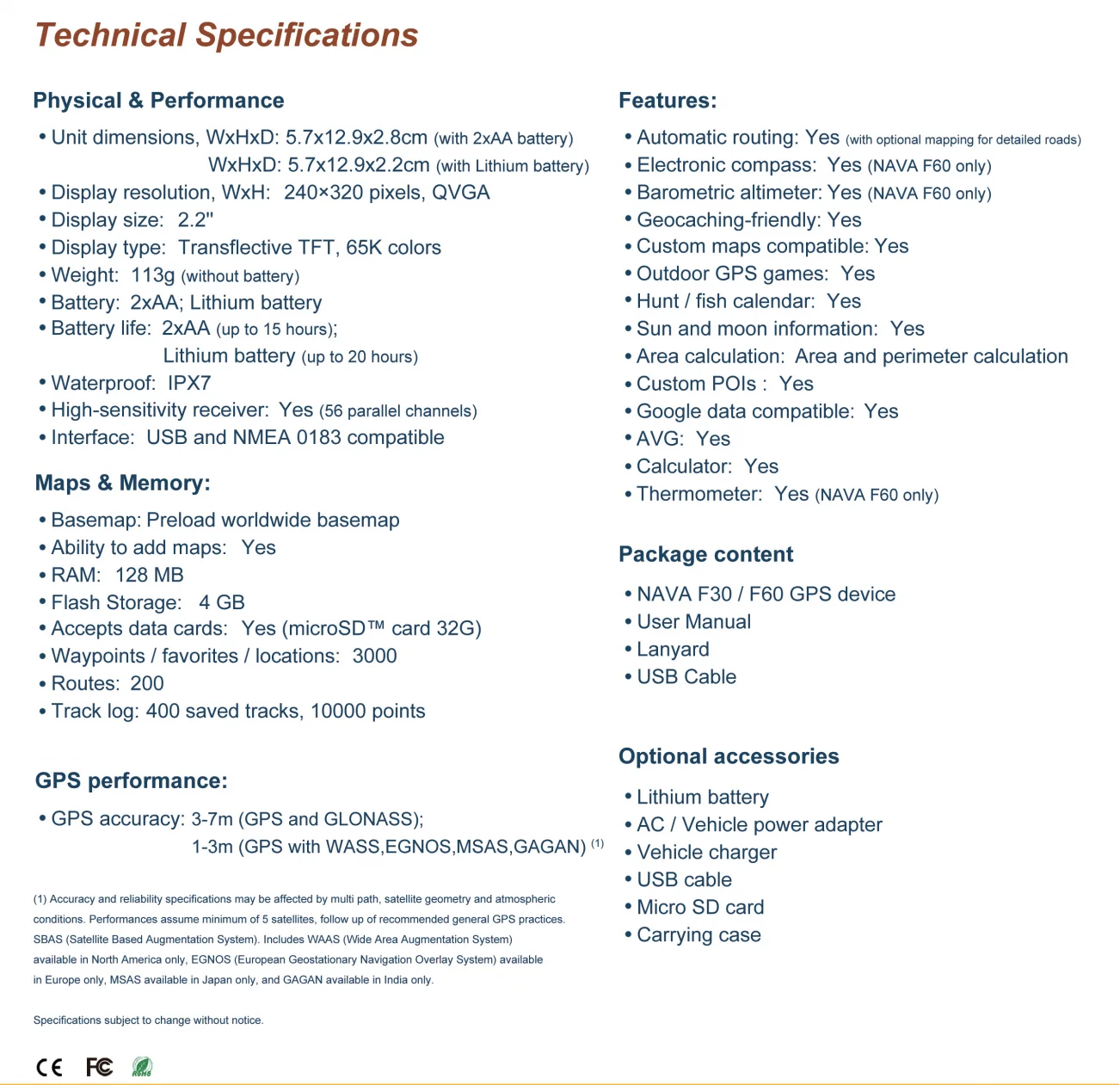
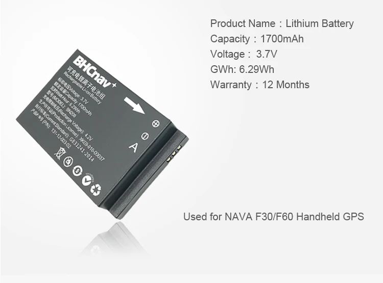
Battery: 2xAA;Lithium battery
Battery Included: Yes
Brand Name: Nohawk
Certification: CE,FCC,RoHS,weee
Display size: 2.2
High-concerned chemical: None
Laser hazard level: Class 1(<1mW)
Measurement Accuracy: 3-7M(GPS and GLONASS) /1-3M(GPS with WASS,EGNOS,MSAS,GAGAN)
Model Number: Handheld GPS F30
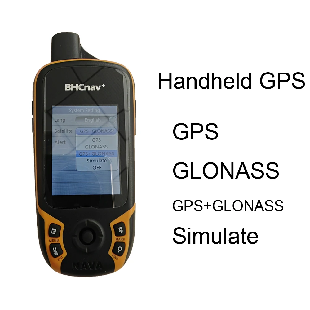
Model1: GPS
Model2: GLONASS
Model3: GPS+GLONASS
Model4: Sikmulate
Origin: Mainland China
Power Source: Battery-Powered
Power Type: Battery-Powered
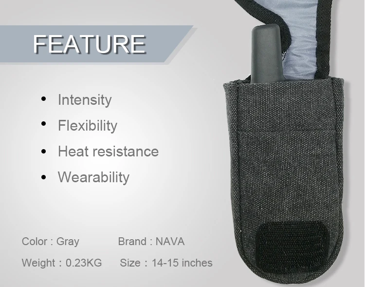
Size: 5.7x12.9x2.8cm
Waterproof: IPX7
Weight: 113g(without battery)
MIni Handheld GPS GLONASS with Waypoint Route Track Trip Map for Sailing track position marker hunting fixed point Hand Help Satellite Navigation
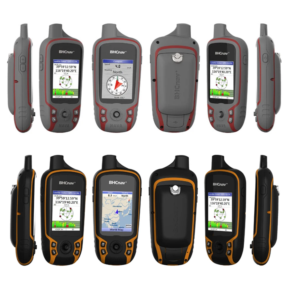
High sensitivity handheld GPS&GLONASS
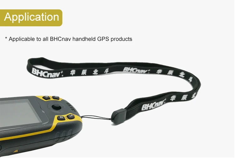
Portable&Rugged
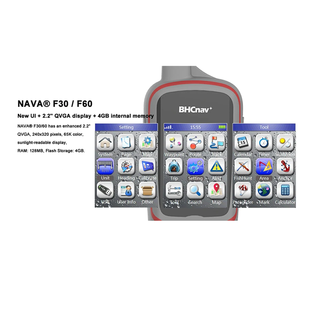
4GB internal memory
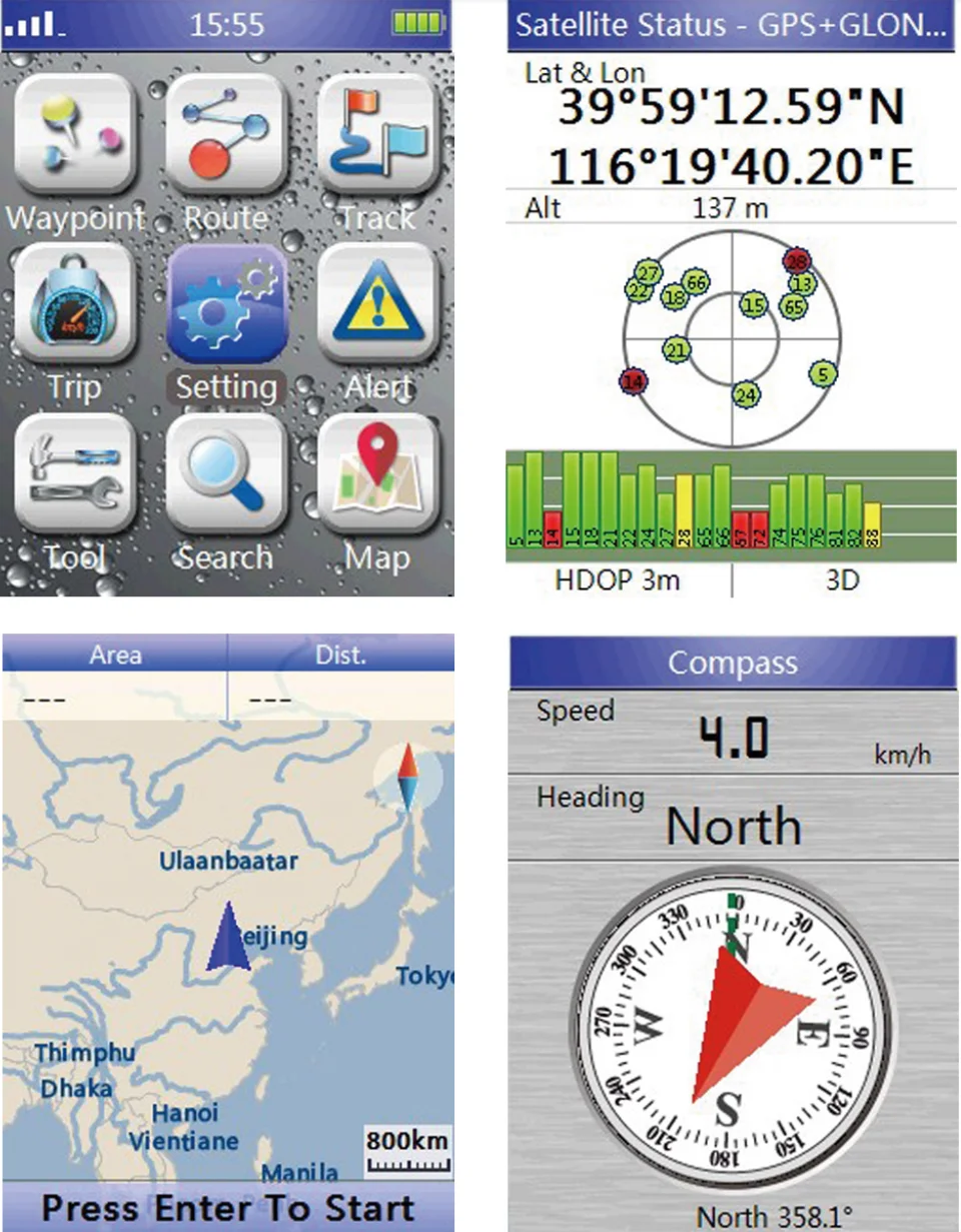
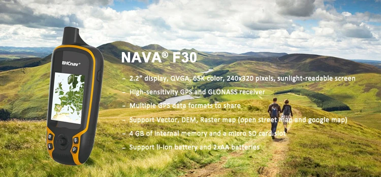
2.2”QVGA,65K color,sunlight-readable screen
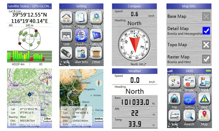
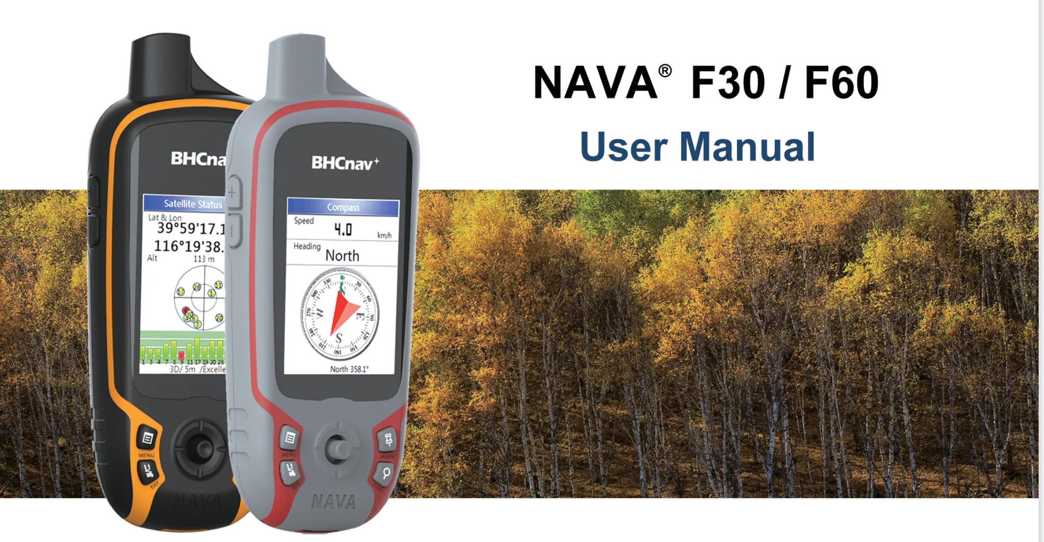
Barometric altimeter, 3-axis E-compass,Thermometer
Outdoor navigation
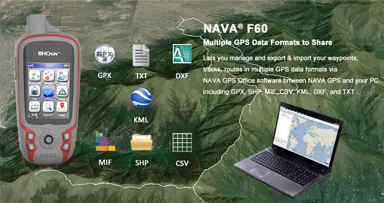
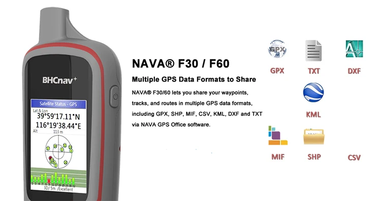
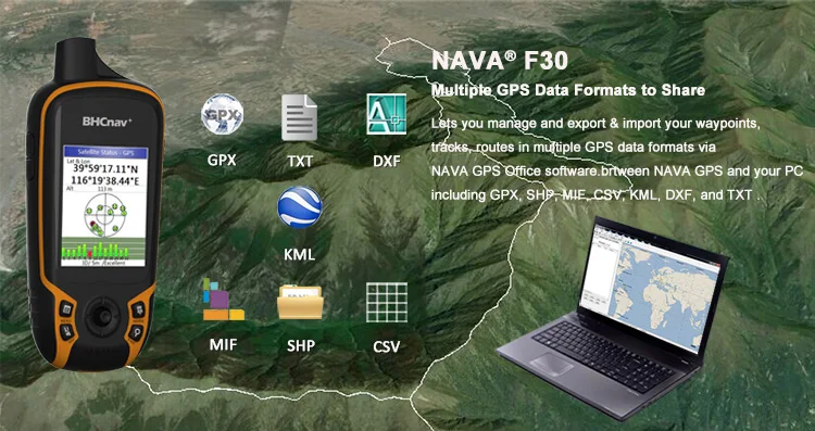
GPX,SHP,MIF,CSV,KML,DXF,TXT data formats supported
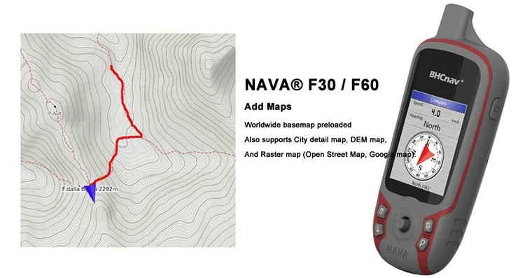
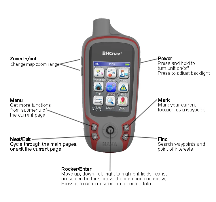
See the Way
NAVA°F30/F60 has an enhanced 2.2",65K color, 240x320 pixels sunlight-readable display. Durable,portable and waterproof,
NAVA°F60 adds a built-in 3-axis electronic compass, which
shows your heading even when you're standing still, without holding it level. Also added is a barometric altimeter.
Excellent GPS & GLONASS Performance
NAVA°F30/F60 supports not only GPS but also GLONASS, with
its high-sensitivity, WAAS, EGNOS, MSAS,GAGAN-enabled GPS receiver, NAVA° F30/F60 locates your position quickly and precisely and maintains its location even in heavy cover and deep canyons.
Multi-purpose Handheld GPS
NAVA° F30/F60 is an ideal rugged GPS & GLONASS receiver for a large range of applications from Agriculture, Forest and Biology, Mining,Surveying, Outdoor, Nautical, Hydrographic studies,
Engineering disciplines,Geographical(GIS) and Urban information
systems,Municipalities and Public works directorates,Electricity Electronics,Geological studies, Sporting, National Real Estate -land survey directorates, Remote sensing, Public sector and institutions, Planning and First draft projects … .
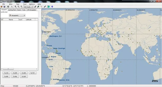
Add Maps
Worldwide basemap preloaded, and NAVA ◎F30/F60 also supports City detail map, DEM map, and Raster map.
Multiple GPS Data Formats to Share
NAVAO F30/F60 lets you manage and export & import your waypoints, tracks and routes in multiple GPS data formats,
including GPX,SHP,MIF,CSV,KML,DXF,and TXT via NAVA
Unit dimensions:5.7X12.9X2.8cm
Weight:113g (without battery)
Waterproof:IPX7
Track log:400 saved tracks, 10000 points
Application:Land Surveying,hunting, outdoor adventure, outdoor tagging
 Provide electronic version and detailed instructions when shipping
HIGH PRECISION ACCURACY: Great support GPS, GLONASS Navigation Satellite System, Super strong signal, provide instant and precise positioning, With high-precision technology, area measurement error: 1-2%
LARGE LCD: 2.2screen that makes more clear and visually, you can set the local time for the area measure.
MULTIPLE MEASUREMENT FEATURES: GPS area measuring tool of any shape (mountainous land, slope and flat field),and measure length of any shape (straight line,curve);figure track and automatically calculate price measurement.
DURABLE AND RESONABLE DESIGN: With strong waterproof and dust-proof function, can protect the area measure to the maximum extent; With portable design, fits in your hand or pockets perfectly; Rubberized case offers a comfortable feeling of grip.
WIDE RANGE OF APPLICATIONS: Apply for land segmentation, harvesting, hillside measurement, exploration, farmland, lake surface measurement and so on.